
Ofbyld:Locationmap Korea.png
Gjin hegere resolúsje beskikber.
Locationmap_Korea.png (250 × 115 pixels, bestânsgrutte: 5 KB, MIME-type: image/png)
Gearfetting
| Beskriuwing |
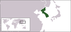
English: The location of the Korean peninsula. |
|||
| Datum | 16 augustus 2004 (original upload date) | |||
| Boarne | This map was created using the existing Image:LocationSouthKorea.png contributed by User:Vardion. | |||
| Auteur | Kokiri at Ingelsk Wikipedy | |||
| Oare ferzjes |
|


Lisinsje
| This file is licensed under the Creative Commons Attribution-Share Alike 3.0 Unported license. Subject to disclaimers. | ||
| ||
| This licensing tag was added to this file as part of the GFDL licensing update. |

|
Der wurdt tastimming jûn ta kopiearjen, fersprieden en/of wizigjen fan dit dokumint ûnder de betinksten fan de GNU-lisinsje foar iepen dokumintaasje, ferzje 1.2, as eltse lettere ferzje útjûn troch de Free Software Foundation; sûnder Ynfariante Seksjes, sûnder Omkaftteksten foar de Foarkante en sûnder Omkaftteksten foar de Efterkante. In kopy fan de lisinsje is opnaam yn de seksje "Text of the GNU Free Documentation License". Subject to disclaimers. |
Original upload log
The original description page was here. All following user names refer to en.wikipedia.
- 2007-07-20 02:50 IAMTHEEGGMAN 250×115× (4768 bytes) Updated to borders at the time...
- 2004-08-16 18:18 Kokiri 250×115× (3976 bytes) map showing location of the Korean peninsula
Triemskiednis
Klik op in datum/tiid om it bestân te besjen sa't it op dat stuit wie.
| Datum/Tiid | Miniatuer | ôfmjittings | Meidogger | Opmerking | |
|---|---|---|---|---|---|
| lêste | 30 sep 2012, 02.08 | | 250 × 115 (5 KB) | OgreBot | (BOT): Uploading old version of file from en.wikipedia; originally uploaded on 2007-07-20 02:50:53 by IAMTHEEGGMAN |
| 18 feb 2005, 14.01 |  | 250 × 115 (4 KB) | Knutux | location of the Korean peninsula. |
Bestânsgebrûk
De neikommende side brûkt dit bestân:
Globaal bestânsgebrûk
De neikommende oare wiki's brûke dit bestân:
- Gebrûk op ar.wikipedia.org
- Gebrûk op be-tarask.wikipedia.org
- Gebrûk op en.wikipedia.org
- Gebrûk op et.wikipedia.org
- Gebrûk op hr.wikipedia.org
- Gebrûk op it.wikinews.org
- Gebrûk op jv.wikipedia.org
- Gebrûk op km.wikipedia.org
- Gebrûk op ms.wikipedia.org
- Gebrûk op nl.wikipedia.org
- Gebrûk op ro.wikipedia.org
- Gebrûk op sah.wikipedia.org
- Gebrûk op sh.wikipedia.org
- Gebrûk op tl.wikipedia.org
- Gebrûk op uz.wikipedia.org
- Gebrûk op wuu.wikipedia.org
- Gebrûk op zh-classical.wikipedia.org
- Gebrûk op zh-min-nan.wikipedia.org
- Gebrûk op zh-yue.wikipedia.org